Carol Zuber-Mallison • ZM Graphics, Inc.
Custom infographics, GIS, cartography, and data visualizations for print, web, and presentation
TEXAS ALMANAC

The Texas Almanac is the official factbook of Texas with roots reaching back to 1857. It is published biannually and is a whopping 750 pages of data on Texas.
For its 2006-2007 Sesquicentennial Edition, the Almanac commissioned me to modernize each of the aging, pen-and-ink county maps to full-color, digital images with topographical bases. It was a huge undertaking since there are an exhausting 254 counties in the state. But the results were bright and beautiful.
With help of an apprentice, I was able to complete all the maps, plus a couple dozen additional statewide maps (see below), in less than a year. Since the maps are now editable vectors, the Almanac staff can do their own updates as needed.
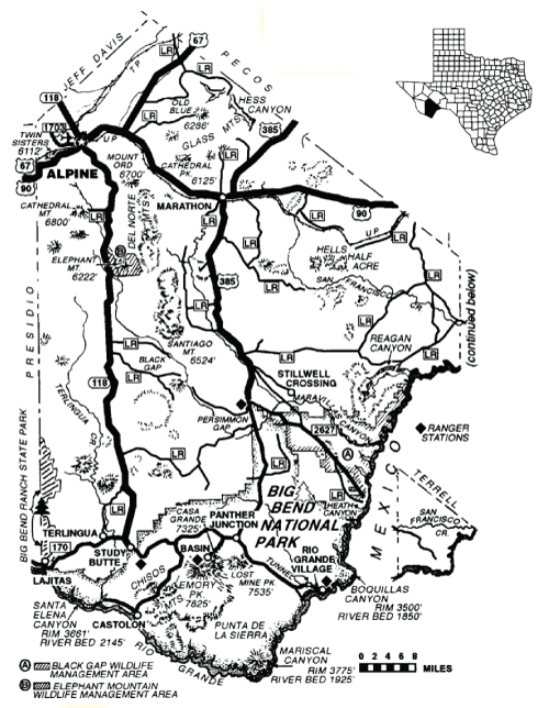
Historic pen-and-ink map of Brewster County, Texas. I reworked 254 of these county maps into the full-color, vector, topographical maps.

